Showing posts with label Gulf Islands. Show all posts

Tuesday, 19 May 2015

Pender Island, BC - Brooks Point Park

A very scenic walk to take on Pender Island is Brooks Point Park and Gowlland Point.


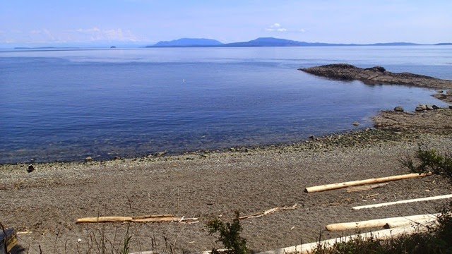
First, drive to the very end of Gowlland Point Road on Southern Pender Island and walk down the staircase to the beach at Gowlland Point.  Here you can see across the water to islands in the distance such as Orcas Island in the USA.

At Gowlland Point, Pender Island 
Look for a trail up to the grassy bluff on the right hand side. Take this trail and follow it over to Brooks Point Park.


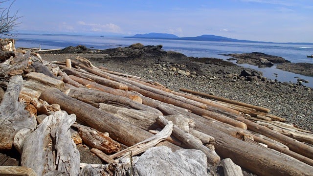
The path leads to another beach, with many interesting shaped beach wood and carved out rocks.


Go back up onto the grassy bluff and continue onwards.


Another beach is just over the next rocky slope.


Choose your favourite beach and stay a while!

Pender Island Stroll- Trincomali Beaches

On Pender Island, BC a great area to explore is the neighborhood of Trincomali. Located at the very end of Pirates Road on North Pender Island, there are a few great beaches within an easy stroll of each other.

Start first at the end of Plumper Way. There is an public ocean access at the end of the road, leading to a family friendly beach in a nice, protected cove.


Then walk back along the road to Trincoma Place. At the end of this road on the right hand side is another ocean access point.

View Across the Water 


Enjoy the beautiful views and check out the tide pools when the tide is low. 


Now head back on Trincoma Place to another ocean access point along the road. Go down the stairs.


This is a beautiful beach with some white shell sand, looking across Starvation Bay towards the Poets Cove Marina.


Enjoy your beach day.

Thursday, 30 October 2014

Port Washington, Pender Island - History, Beauty and a Mink


Walking in the Port Washington area of North Pender Island is a pleasant amble amongst coastal ocean viewpoints, charming cottage houses and historic buildings, farmhouses, and orchards.

Start at Port Washington, for easy parking, and then walk up towards Otter Bay Road to the Grimer Bay ocean viewpoint.
Climb down the stairs to the water. There is no beach here, just a lookout on some rocks.
Vintage Boathouse at Grimer Bay 
View Out Over Grimer Bay, Pender Island
Head back towards Port Washington. Check out the cottages and orchards along these quiet roads. Old Orchard Farm, one of the original residences of this area, has many apple, pear and plum trees.
Quiet Country Roads
Port Washington was one of the original pioneering communities on Pender Island. Head towards the old General Store, first established in 1910. The building ceased as a general store in 1987, and has fallen a bit on harder times with no current commercial tenant.
Old General Store, Port Washington Pender Island 
Walk down to the dock. This is a floatplane terminal now as well as boat dock, where Pender high school students can catch the watertaxi boat over to school each week day on neighbouring Salt Spring Island.

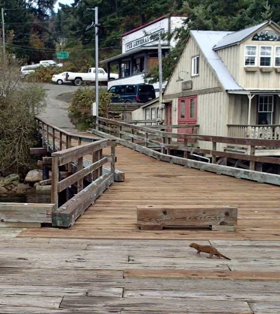
Down on the dock, I saw what appeared at first to be an otter, but as it ran closer across the dock, I saw it was too small to be an otter, it was a mink. These are sometimes spotted near the water on Pender Island.
Mink Crossing Port Washington Dock, Pender Island 

Head for the Hills
You never know what you may spot on a walk here on Pender Island!

Monday, 29 September 2014

Disc Golf On Pender Island -A Must Do

A fun thing to do on Pender Island is to check out the Golf Island Disc Park. This is located on North Pender Island in the Magic Lake Estates, on Galleon Way at the top of the hill.

Disc Golf On Pender Island, A Must Do 
There are 27 holes, with the first 9 being poles and the rest being baskets. It's a great course for all ages, beginner or experienced, and the best thing is, it's free! All you need is a disc. Play as much as you want of it, you can just do 9 holes to try or do the whole 27.

Chain Baskets Make Up Many Of The Holes 
The course is in a beautiful, forested setting, all the more challenging for throwing your disc as the trees frequently pose obstacles. But that is part of the fun.
Start Area and Clubhouse
Holes Are Clearly Marked 
It's also good that there is not too much underbrush in this part of the forest, as it's easier to not lose your disc after a bad throw!

Throwing To The Pole At The Top Of The Hill (Almost There!)
It's great fun to try disc golf . Give it a try!

Hike Up Castle Road Trail on South Pender Island

On a clear day, one can climb up Spalding Hill on South Pender Island to see the views. It is a short, but steep climb up some switchbacks, so you will get a good workout for the first fifteen minutes or so. The trailhead is on Castle Road.

Ready To Start The Climb
It only took me about ten or fifteen minutes to climb up to a bench , much needed for a rest.

Rest Area 
This area doesn't really have a view, but if you climb a small hill behind the bench to a bluff, there was a great view of Mt. Baker in Washington State. Try to go here on a clear day to be able to see it.

Beautiful Mt. Baker Off In The Distance 
After this viewpoint, you may as well hike back. The trail continues up further through forest , but then ends suddenly without much further views.

On Castle Road, also check out Lilias Spalding Heritage Park near the end of the road, for some local history. This historic property and homestead was once home to Lilias and Arthur Spalding, who lived here in the early part of the last century. The house that once stood there was torn down in the 1950's , but what remains are the remnants of an old farm building and an orchard. There is a picnic table to sit at and linger.

Remnants Of An Old Homestead Farm Building 
Have fun exploring Pender Island.

Pender Island- Hike to Greenburn Lake

A short hike to do on Pender Island is a walk to Greenburn Lake. This small lake is located on South Pender Island.

Greenburn Lake on South Pender Island 


If you like, you can walk from Poet's Cove Resort, about 5 minutes up the road to the start of the trail, or just park on the side of the road near the firehall on Gowland Point Road. The trail is marked near there, and is a wide path that slopes uphill . It will take about ten minutes or so to walk up, and is a good workout.

Wide, uphill trail 
After a short hike you will come to the small lake. I saw evidence on some trees and branches of a beaver gnawing on it, so there is one in the area. This lake is a good place to view wildlife and birds as it is very quiet and peaceful, away from any crowds. One could lay a blanket on the sunny spot of the trail near the grass to stay awhile and enjoy the solitude.

Peace and Solitude in Nature 

When you are done, head back down the trail the way you came. You can end your walk with a stop at Poet's Cove Resort, just a few minutes down the road. Have a drink on their pub patio or just sit and enjoy watching the boats in the marina.

Poet's Cove Resort on Pender Island 


Wednesday, 12 June 2013

Mt. Galiano

This is a must do hike on Galiano Island. I've passed by Mt. Galiano so many times on  BC Ferries, as it is located right overlooking Active Pass, the main route for the Vancouver-Vancouver Island ferry.

To get to the trailhead, drive to Active Pass Dr. and follow the signs to the parking lot. It took me about 45 minutes to reach the top and then about another 35 minutes to come down, so plan your time accordingly. You also want to allow some time at the top to enjoy the view.

The first part of the trail is a bit of a climb, and you will also have to watch your footing as you switch back up , with lots of rocks and tree roots to navigate. Then you will come to a wider trail that is easier to walk and climbs more gradually for the rest of the way up. Look out for the remnants of wreckage from a small plane crash years ago on the side of the trail.

The summit of Mt. Galiano is 311 metres, and there is a grassy clearing for you to see all the great views. Careful though as there is quite a dropoff near the edge.

This is looking towards Mayne Island on the left with Pender Island on the right.


This is looking towards Salt Spring Island in the background and Prevost Island straight ahead. 


Looking towards Pender Island .


If you can, try to do this hike on a clear day, as I understand some days you can even see Mt. Baker  and the Olympic Mountains in Washington State. When you are done, just turn around and hike back the same way. 

Enjoy the beauty and happy hiking! 

Pebble Beach on Galiano Island

It is a nice hike down to Pebble Beach on Galiano Island. To access the trail , go to the end of McCoskrie Rd. and park. There is a sign at the trailhead with a map. I did a loop trail , and it took about 30 minutes or so.

It's an easy walk through Crown forest to the shoreline. It was low tide so that made it good for walking  on the rocks. It is a quiet place to go, so keep an eye out for wildlife. I saw this heron chilling out by the water.


The rocks are interesting to look at with all the colours and textures of the west coast. Check out the tide pools for interesting sea life and creatures.


The views from the shore look east towards Vancouver and the mainland. Quite a view I'm sure on a clear day , looking towards all the Coast Mountains. This day's view was a bit cloudy though , so can't quite see it in full glory. 

On the walk back, you will loop back onto a road. This area is near the Great Beaver Swamp, an area on Crown land that has recently seen beavers revitalized after some decades of decline. Apparently the beavers have been very busy, and you will definitely see their swamp on one side as you walk back, the outcome of their beaver dam perhaps.


Secret Sea Cave on Galiano Island

I had heard of a cool sea cave on Galiano Island, so I had to check it out.  It can be reached by driving to the end Retreat Cove Rd. on the northern part of Galiano Island. There is a gate on the left and a very short trail down to the shore. Be respectful as this is private land.  Once on the shore, climb down the rocks and the sea cave is on your left. Try to time this for low tide so you can access it better.


It's amazing what nature can carve out.


Bodega Ridge , Galiano Island

I recently visited beautiful Galiano Island, located in the Southern Gulf Islands between Vancouver and Vancouver Island. Cited to be the land size of Manhattan, but with a population of just 1000 people, it's easy to feel like you really are getting away from it all. There are lots of hikes to do on Galiano Island and many beaches to explore.

Bodega Ridge Provincial Park is a good hike to do if you are looking for some beautiful viewpoints, but might not be suited for kids as you walk right on the edge of a steep ridge for some part of it.

To reach the trailhead, drive to the end of Cottage Way on the northern part of the island, and park.  The trail climbs gradually through forest, and you will soon see you are on the ridge as both sides off the trail slope downward. The ridge is about 4 km long and rises about 328 metres above sea level.

Signs will tell you when you are nearing the cliff area, so use caution obviously here. The views are great, even on the cloudy day that I went.


It's about a 30 minute walk to the ridge view area. The trail appeared to keep going, but I turned around when it started to descend as I didn't want to go all the way down the other side. So just turn around when you reach the end of the open cliff area.

You look over Trincomali Channel towards Vancouver Island in the far background.


You can also see views of Salt Spring Island across the channel.